
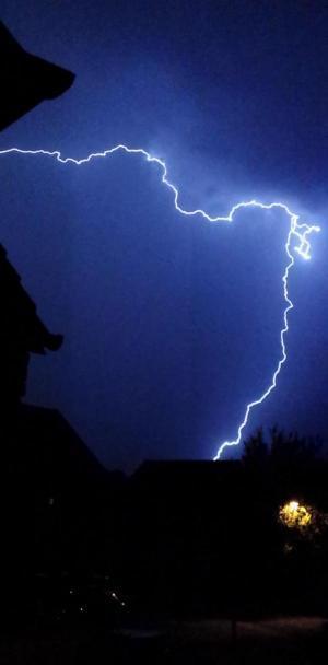
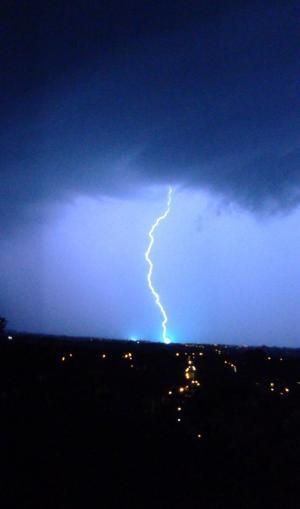
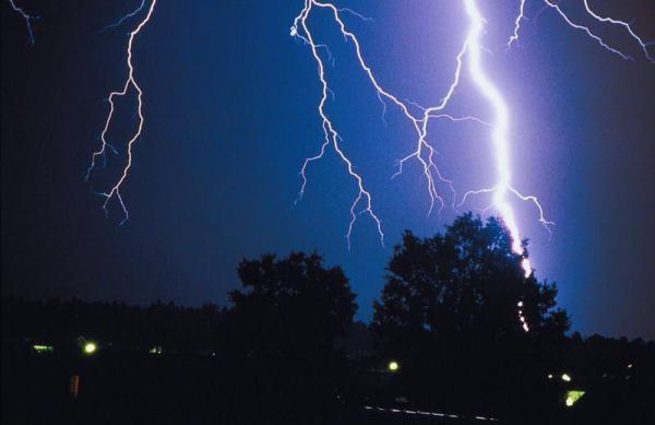
Readers have sent us these dramatic pictures of lightning taken during last night's thunder storm.
Did you take any? Please send them to bclements@newswilts.co.uk
Meanwhile weather experts have issued TWO warnings - one for a heatwave today and the other for heavy rain, lightning strikes and localised flooding tomorrow.
Temperatures across many southern parts of England are expected to top 30C (86F) today - ousting yesterday's 29.2C (84.5F) in London as the hottest of the year - with some parts of the South East reaching at least 32C, perhaps higher.
The Met Office warned of a 60% chance of a heatwave until 8am on Sunday in parts of the country.
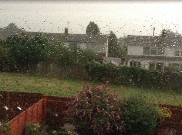
But a new weather pattern moving into the UK from the south will bring wet and humid weather tonight, which is expected to erupt into thundery downpours by the early hours of tomorrow.
In a severe weather warning, the Met Office said on its website: "Areas of heavy, thundery showers will develop over England and Wales from Friday night before moving northwards into Scotland during Saturday.
"The location of these is uncertain but where they do form some torrential downpours are possible with frequent lightning, large hail and locally strong gusts. Significant flooding is possible where these do occur from surface water as well as from small, fast responding watercourses.
"The frequent lightning, large hail and strong gusts could also be an additional hazard."
Nick Prebble, a forecaster with weather forecasters MeteoGroup, said areas of Essex and Greater London could see 32C (89.6F) today, while anywhere from the East Midlands through East Anglia and parts of Kent would likely break the 30C (86F) barrier.
He said: "Elsewhere it is less warm, but still in the mid to high 20s across much of England and Wales. The further north and west you go it will be less warm - the west coast of Wales and Scotland will be about 20C (68F) - which is not bad, but certainly not as hot as in the South East."
He added: "In the UK there is no official definition of what a heatwave is. But the World Meteorological Organisation has one which says if the maximum temperatures exceed five degrees above the norm for five consecutive days, that is a heatwave.
"Average temperatures for this time of year are 21C (69.8F) or 22C (71.6F) in Greater London, so we are quite a few degrees warmer than average."
The changing weather pattern is being triggered by a plume of unstable air moving into the UK from the south. Despite the lightning and thunderstorms expected tomorrow, it will still be hot.
Mr Prebble said: "Tomorrow will be the worst day of the week, but temperatures in the South East will be 29C/30C (84.2-86F) again, so it will be warm and humid."
Around the UK temperatures yesterday peaked at 25.1C (77.1F) at Hawarden Airport in Wales, with highs of 22.8C (73F) and 23.2C ( 73.7F) in Scotland (Fife) and Northern Ireland (County Down) respectively.
The hot, humid conditions prompted Public Health England (PHE) to warn of potential dangers, stating that heatwave conditions could have a "significant effect on health".
Public Health England said people should consider staying out of the sun during the hottest part of the day, drink plenty of fluids and wear sun cream that is at least factor 15.
It has also asked people to be aware of children and the elderly, to ensure they are not suffering because of the heat.
The Environment Agency has also said there is a risk of localised flooding over the weekend as a result of intense rainfall.


Comments: Our rules
We want our comments to be a lively and valuable part of our community - a place where readers can debate and engage with the most important local issues. The ability to comment on our stories is a privilege, not a right, however, and that privilege may be withdrawn if it is abused or misused.
Please report any comments that break our rules.
Read the rules hereLast Updated:
Report this comment Cancel